


People Love Downtown Cape, so Why Doesn't More of Cape Look Like Downtown?
What would a more pedestrian-friendly version of Cape Girardeau look like for the people who live here, work here and love coming here?

I have built my entire life around Cape Girardeau. My friends and family are here, and I attribute some of my strongest relationships to the welcoming design of Downtown Cape. If this area wasn’t as friendly to walkers, I doubt I would have ever met some of the people I call my best friends.
I love walking along the riverfront and going shop-to-shop on Saturday mornings after the Farmer’s Market. There’s always a chance to run into my friends and make deep, lasting connections with new people. Money spent downtown stays in Cape and supports my friends’ businesses and market stands.
In public spaces, all sorts of different backgrounds, age groups, political views and ways of life meld together in a way we don’t really see on social media due to divisive algorithms. Dense, walk-able spaces open to the public help people get out of their bubbles and see perspectives they otherwise never would have.
These spaces exist in droves in downtowns all over the world. And what I find particularly interesting is how, as I walk west from the Mississippi, the downtown space becomes more and more spread out. In a way, it’s like time suddenly accelerates forward. To understand what I mean, you need to understand how Cape grew.
A City-Wide Time Capsule
When Cape was founded in the 18th century, people lived where they worked and walked most places, because the infrastructure supported this. During the 19th century, coal and steam power ruled. People could hop on trains to get from town to town, and bustling, dense city centers were built up around train stations and other mass transit features. Around the world, cities were built like this for millennia, up until just after the turn of the 20th century.
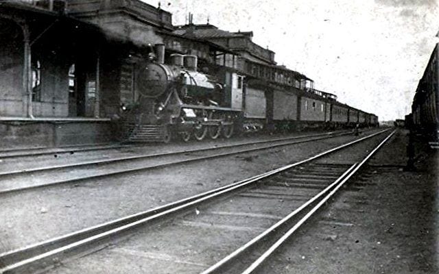
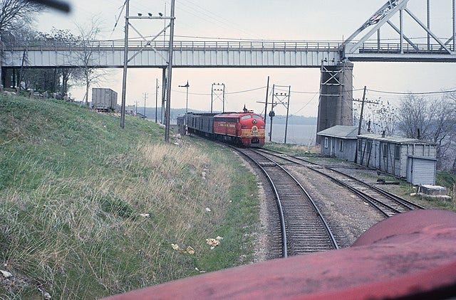
This “mixed-use” pattern, where people live close to where they work, starts to taper off as you move away from the Mississippi, because more and more people could rely on their car. However, not everybody could afford one, so the city’s infrastructure thoughtfully supported walking and alternative transportation options like the streetcar and the Frisco passenger train depot, which sadly shut down in 1930s and 1960s, respectively. Today, the area between Water Street and West End Boulevard remains the most walk-able and pedestrian-friendly area in Cape.
But if you start moving west from there, you’ll see a new development pattern - one where the automobile is king. Building up in the 1930s and really kicking off after World War II ended, the automobile completely changed how North Americans built their cities. As a result, businesses are farther apart, there are fewer sidewalks and safe places to walk or cycle, parking lots cover more space than is necessary and people, on average, live much farther away from where they work.
This cycle continues until one pretty much must have a car in order to participate in society. While it’s not impossible to walk or cycle everywhere, the car-centric infrastructure certainly does not help.
Why We Love Downtown
I think a key ingredient that makes Downtown special is that there is ample public, walk-able space around which a thriving community is built. The mixed-use development pattern, wide sidewalks and less space between buildings all offer denizens a chance to connect with the world around theme in a way that’s much harder when confined to an automobile. These rich public spaces are why so many people are attracted to downtowns all over the world. People love vacationing in places where the walkability score is high (consequentially, this includes Disneyland).

There might be a formula to make our city like this in more places than just downtown - where people don’t have to get into their car and drive because they live close enough to amenities that make their lives easy. A quiet, local cafe on their street. A grocer on the corner. A barbershop down the street, or a public library within walking distance.
Having more places like this should also have the added side affect of creating more affordable housing all throughout Cape, increasing our quality-of-life as a whole.
To make our city more connected, more attractive, and more affordable, there are a few things I would love to see.
More thoughtful street design
William, Independence and Broadway could be part of a road diet for much of their span. Imagine for a moment how much more welcoming these streets would be for homes and businesses along them if they were made narrower, safer, and more pedestrian-friendly. Cities all over the United States have gone through or planned road diets, with much success. The US Federal Highway Administration has an official document on planning road diets.
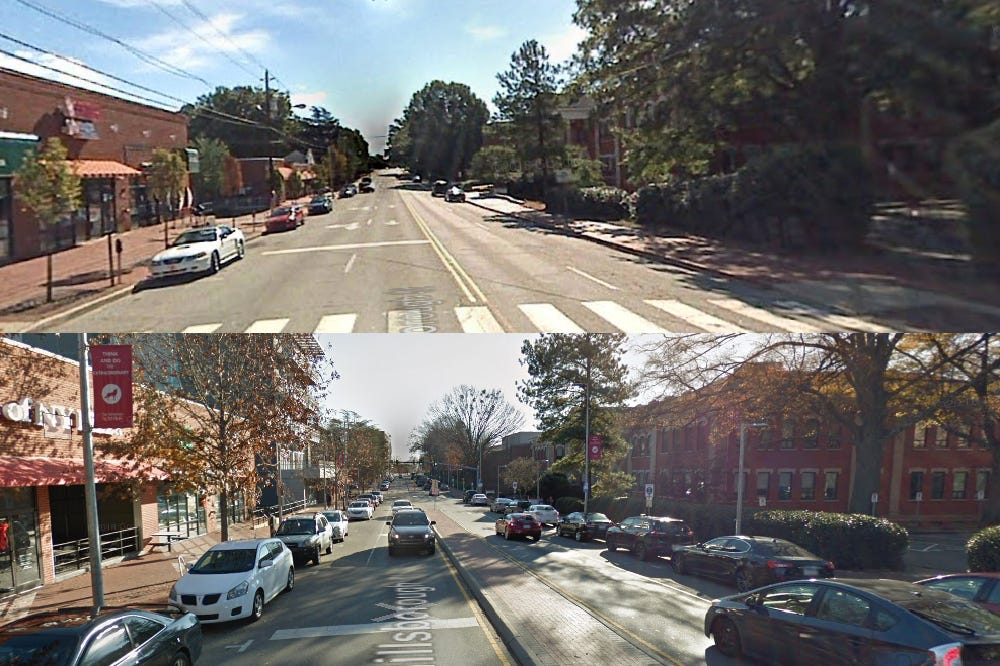
Four lanes of William and Broadway (between Water Street and Caruthers) could be reduced to two driving lanes a turning lane (or tree-lined median.) Bike lanes stretching the length of the street would connect cyclists with more of the city. With on-street parking, businesses wouldn’t need vast parking lots, and more buildings can be built along these streets.
There are homes along William, Independence and Broadway which would benefit from such a diet, making their neighborhood more attractive overall and a more pleasant place to live and play.
More comprehensive cycling infrastructure
A north-south corridor called the Cape LaCroix trail runs from the South Side of Cape to Route W. Unfortunately, there's no real east-west corridor for cyclists to ride safely from downtown to the western parts of Cape.
Promoting cycling with SAFE bike lanes, not just painted-on lines, will further reduce car traffic and pollution (the more bikes are on the road, the fewer cars there are, giving drivers more room). Bike lanes and wide sidewalks would also encourage more foot traffic and higher patronage to businesses along them, and the shops and restaurants on Broadway would benefit the most from this due to their proximity to the university.
More mixed-use zoning and fewer parking minimums
Large parking lots offer less space for housing or other public amenities (like pedestrian plazas) to be built. A loosening of these restrictions has the potential to reduce housing costs because the supply of homes increases. In addition, mixed-use zoning would allow more people the freedom to have their own business on the first floor of their own home while living above it.
Mixed-use commercial+residential means that people can work close to where they live, which further reduces the need for long commutes and car traffic, supporting the points I made earlier. But as it stands under Cape’s zoning code, owning a for-profit business is illegal in much of Cape Girardeau if you live in the same building.
Downtown Cape is really nice, but it's pretty much the only place where you can both live and work without needing to get into your car. The zoning map below shows that currently, the only mixed-use zoning available is downtown. The sea of green up north is mostly single-family suburban residential - large lots owned by a single family - and where most commercial activity isn’t allowed.

A Way Forward
A Cape Girardeau with denser, mixed-use neighborhoods gives us the benefits of less traffic, lower housing costs, less pollution, and a more closely-connected community.
I fully believe that this is something we can see in our lifetimes.
Mixed-use zoning doesn’t have to be restricted to just one place in the city. The good thing is that if someone wants to live in a single-family home - that would still be feasible.
But there are so many people who would want to open up a cafe, bookstore, barber shop and so many other communal spaces we need to mix around and exchange ideas as a civilized society. Other important communal spaces like schools, parks and public libraries shouldn’t be as separated from people who live here and should be within walking and biking distance.
Opening up our city to safer ways to get around doesn’t have to be disruptive. It just may lead to a more connected Cape.